-
LabVIEW and Testing Technologies Academy
Si informano gli studenti iscritti ai Corsi di Laurea Magistrale in Ingegneria, Fisica e...
-
Challenges in Modeling Ammonia Combustion Using Methodologies Originally Designed for Hydrocarbons - Seminario
Lunedì 22 Giugno 2026 alle ore 10, nell'Aula Magna del Polo di Ingegneria, il Prof. Cosmin...
-
From Pixels to Policies: How Satellite Radar is Reshaping Risk, Response, and the Future of Earth Observation - Seminario
Giovedì 18 Giugno 2026 alle ore 15, nell'Aula Magna del Polo di Ingegneria, il Prof. Pietro...
-
Avvio Lavori del nuovo edificio del CROSS – LAB
Mercoledì 10 giugno 2026 alle ore 12.00, presso l’Aula Magna del Polo di Ingegneria...
-
Terzo "PhD Workshop" del Dipartimento d'Ingegneria
Siamo lieti di invitarvi al terzo PhD Workshop della Scuola di Dottorato in Ingegneria Industriale e...
-
Bando per l'assegnazione di contributi a sostegno dello svolgimento di tirocini curriculari A.A.2025/2026
L’Università degli Studi di Perugia indice una selezione finalizzata all’assegnazione di...
-
Workshop REMPOWER 2026: il futuro dell’energia passa dallo spazio
Il Dipartimento di Ingegneria dell’Università degli Studi di Perugia ospiterà il Workshop del...
-
Al Polo di Ingegneria l’inaugurazione del Laboratorio Internazionale CAOS
Giovedì 14 maggio 2026 alle ore 15.00, presso il Polo di Ingegneria dell’Università degli Studi di...
-
New Insights into Millimeter-Wave Higher-Order Mode Array Antenna Design - Seminario
Giovedì 14 Maggio 2026 alle ore 15, nell'Aula Alessandri del Polo di Ingegneria, il Prof....
-
Open Day Unipg 2026
L’8 maggio 2026 il Barton Park ospiterà l’Open Day dell’Università degli Studi di Perugia, una giornata...
-
From Pixels to Perception: Beyond Napoleon’s White Horse - Seminario
Il giorno 4 maggio alle ore 16:30 presso l'Aula Magna di Ingegneria, il Dr. Ricardo Marroquim...
-
L'innovazione per la sicurezza sul lavoro nasce dalla ricerca condivisa
Il Dipartimento di Ingegneria dell'Università degli Studi di Perugia, con il Prof. Luca Landi,...
-
Presentazione delle Lauree Magistrali - Ingegneria Informazione
Il giorno 16 aprile 2026, nell'orario 16.30-18.00, in aula 3, verranno presentati i Corsi di...
-
Il Biochar una soluzione per l'agricoltura, il clima e l'energia: i modelli di business sostenibile surfoly e wasyng per i sottoprodotti dei frantoi
Con piacere si invita a partecipare all'evento organizzato nell’ambito della manifestazione...
-
Elezione rappresentanti docenti Commissione Paritetica del Dipartimento di Ingegneria - 2026
Indizione per il giorno 9 aprile 2026 delle votazioni per l'elezione dei rappresentanti docenti...
-
Elezione rappresentanti studenti Commissione Paritetica del Dipartimento di Ingegneria - 2026
Indizione per il giorno 9 aprile 2026 delle votazioni per l'elezione dei rappresentanti degli...
-
Seminario – Dr.sse Truver e Kiršbaum
24 marzo 2025 – ore 14:30, Aula D
Si informano colleghi e studenti interessati che le Dr.sse Anna...
-
Università Svelate – Giornata Nazionale delle Università - 20 marzo 2026
Il 20 marzo 2026 dalle ore 15:00 il Polo di Ingegneria ospiterà un pomeriggio dedicato alla...
-
Dall'università al mondo del lavoro: la versatilità dell’ingegnere informatico nell’affrontare problemi complessi - Seminario
Mercoledì 18 Marzo, in AULA MAGNA, alle ore 15:00, si terrà un seminario tenuto da Francesco...
-
Presentazione della piattaforma MATLAB Campus-Wide all'Università degli Studi di Perugia
Mercoledì 11 marzo 2026, alle ore 09:30, presso l'Aula Magna del Polo di Ingegneria (Via Duranti 93,...
-
ADDMAG: Towards ADDitive manufacturing of MAGnetic components for electrical machines and power converters - Webinar
Giovedì 19 marzo, alle ore 17, ci sarà il webinar dal titolo "ADDMAG: Towards ADDitive...
-
Il Dipartimento di Ingegneria ospita WALCOM 2026, conferenza internazionale su algoritmi e computazione
Dal 4 al 6 marzo 2026 il Dipartimento di Ingegneria dell’Università di Perugia ospita la ventesima...
-
Quando l’hardware fa la differenza nell’Edge AI e crittografia: dalla scelta del modello all’implementazione su piattaforme NXP
Martedì 24 marzo 2026, dalle ore 10:00 alle 17:00, presso l’Aula Magna del Polo di Ingegneria, si...
-
Inaugurato l’Anno Accademico 2025-2026
Giovedì 26 febbraio, nell’Aula Magna di Palazzo Murena, si è tenuta la cerimonia di inaugurazione...
-
Premio “Most promising researcher in robotics and artificial intelligence” - scadenza 8 marzo 2026
La Fondazione Mondo Digitale, in occasione della RomeCup 2026, promuove insieme a Corriere della...
-
From the Academy to the Industry: My Parachute-Free Plunge into the Corporate World - Seminario
Venerdì 27 Febbraio 2026 alle ore 15.30-17.30, nell'Aula Magna del Polo di Ingegneria, Marco...
-
The Shapes of Knowledge - Talk
The talk "The Shapes of Knowledge" of Doct. Claudio Battiloro has been rescheduled for February...
-
IEEE AP-S DL Workshop Italy Series - Perugia Edition
Lunedì 2 febbraio 2026 dalle ore 10.00 alle 16:30, nell'Aula Magna del Dipartimento di...
-
ANNULLAMENTO seminario "The Shapes of Knowledge: Topological and Geometric Methods to Learn on Complex Networks"
Si comunica che per improvvisi impedimenti del Dott. Battiloro, il seminario "The Shapes of...
-
The Shapes of Knowledge: Topological and Geometric Methods to Learn on Complex Networks - Seminario
Venerdì 23 Gennaio 2026 alle ore 11.30-13.00, nell'Aula Magna del Polo di Ingegneria, il Dott....
-
Un ingegnere nel Consiglio di Amministrazione dell’Ateneo!
Il Prof. Filippo Cianetti, Presidente dei Corsi di Studio in Ingegneria Meccanica del...
-
Seminario “Artificial Aerodynamics”
Mercoledì 28 gennaio 2026 alle ore 14:30, nell'Aula DING del Dipartimento di Ingegneria, Mark...
-
Al prof. Paolo Carbone importante finanziamento per il progetto di ricerca FLOR
L’Università degli Studi di Perugia è risultata tra i vincitori del terzo bando del Fondo Italiano...
-
Seminario “Open Source EDA Tools: a New IC Design Perspective”
Mercoledì 3 dicembre 2025 alle ore 14:30, nell'Aula 11 del Dipartimento di Ingegneria, Giulio...
-
Seminari - Corso "Deep Learning and Robot Perception"
Venerdì 5 dicembre 2025 dalle ore 11.30, nell'Aula 11 del Dipartimento di Ingegneria, si terranno...
-
Lezione/Seminario “Topological Signal Processing and Learning”
Martedì 9 dicembre 2025 alle ore 11:30, nell'Aula 11 del Dipartimento di Ingegneria, il Prof. Sergio...
-
Votazioni delle rappresentanze della Giunta del Dipartimento di Ingegneria per il triennio accademico 2025/2028
Le votazioni per l'elezione dei componenti della Giunta del Dipartimento di Ingegneria per il...
-
Seminario “Instability, restabilization, and ultimate instability in a material”
Giovedì 27 novembre 2025 alle ore 10:00, nell'Aula 13 del Dipartimento di Ingegneria, Davide...
-
Convegno "INGEGNERIA DELLA SICUREZZA: dal PERCORSO FORMATIVO al RUOLO PROFESSIONALE - SFIDE E PROSPETTIVE"
Nei giorni 27 e 28 novembre si terrà a Foligno, nelle sedi di Palazzo Trinci e del Centro Studi...
-
Proclamazione di 16 neo-dottori in Engineering Management
Il 17 Novembre è avvenuta la proclamazione di 16 neo-dottori in Engineering Management, la laurea...
-
A Joseph Criacci il Premio di Laurea al merito “Riccardo Domenici” XIV Edizione
Si è tenuta martedì 18 novembre, nell'Aula Magna del Dipartimento di Ingegneria dell’Università degli...
-
Seminario “Songs of Ice and Power: Research, Challenges, and Opportunities on Cryo-Noise Sources and EVM Measurements”
Mercoledì 26 novembre 2025 alle ore 14:30, nell'Aula 11 del Dipartimento di Ingegneria,...
-
Seminario “SiGe BiCMOS Integrated Circuits and Systems for sub-THz Communication and Sensing”
Lunedì 24 novembre 2025 alle ore 14:30, nell'Aula 8 del Dipartimento di Ingegneria, Corrado...
-
Flusso di progettazione su MPU e SoC per sistemi embedded - Lezione/seminario 21/11/2025
Mercoledì 21 novembre 2025 ci sarà il secondo appuntamento del ciclo di lezioni/seminario Flusso...
-
Seminario “La geopolitica della microelettronica - la microelettronica nella geopolitica”
Si avvisano tutti gli studenti che il giorno venerdì 21 novembre 2025 alle 12:00 nell’aula 10 del...
-
Prof. Daniele Passeri nominato Vicedirettore del Dipartimento di Ingegneria
Nuova nomina al Dipartimento di Ingegneria!
Siamo lieti di annunciare la nomina del Prof. Daniele...
-
I Sistemi di Gestione e l’Intelligenza Artificiale come vantaggio competitivo per le imprese
Venerdì 28 novembre 2025 alle ore 14:00, nell'Aula Magna del Dipartimento di Ingegneria, si terrà...
-
Ciclo di seminari ToE (Talks on Electronics)
The seminars will be on afternoon from 14:30 to 16:30 Locations: Aula 8 triennio (A8), Aula 11...
-
Prof. Verducci delegato per il settore "Cura del Costruito; Sostenibilità Energetica; Sicurezza"
Orgoglio per il nostro Dipartimento di Ingegneria! Il Dipartimento, come sottolineato dal neo...
-
Seminario “Advanced Radar Concepts at Ulm University: from Automotive to Swarms of UAVs”
Mercoledì 12 novembre 2025 alle ore 14:30, nell'Aula 11 del Dipartimento di Ingegneria, Julian...
-
Seminario “Naturale e artificiale. Un confine labile e una sfida costante, tra etica ed epistemologia”
Giovedì 13 novembre 2025 alle ore 11:30, nell'Aula 10 del Dipartimento di Ingegneria, il Prof....
-
Flusso di progettazione su MPU e SoC per sistemi embedded - Ciclo di lezioni/seminario
Mercoledì 14, 21, 28 novembre 2025 10:30-13:30, Laboratorio Multidisciplinare del Dipartimento di...
-
Passaggio di consegne alla direzione del Dipartimento di Ingegneria
Il direttore prof. Ermanno Cardelli consegna nelle mani del direttore prof. Gianluca Rossi la...
-
Distinguished online lecture - Prof. Vadim Issakov
MICROWAVE LECTURE SERIESFeaturing Prof. Vadim IssakovLecture Title: mm-Wave System and Circuit...
-
Seminario “The role of Simulation in the modern engineering”
Prosegue “La Didattica Portata in Azienda”, il percorso che unisce formazione universitaria e realtà...
-
Elezioni del Direttore del Dipartimento – triennio 1.11.2025 – 31.10.2028
Le votazioni per l'elezione del Direttore del Dipartimento di Ingegneria per il triennio...
-
Elezioni Coordinatore del Corso di Laurea in Engineering Management e del Corso di Laurea magistrale in Engineering Management
Si comunica che sono indette le elezioni del Coordinatore del Corso di Laurea in Engineering...
-
Elezione rappresentanti personale tecnico amministrativo nel Consiglio di Dipartimento – Triennio Accademico 2025/2028
Indizione per il giorno 7 ottobre 2025 delle votazioni per l’elezione di n. 13 rappresentanti del...
-
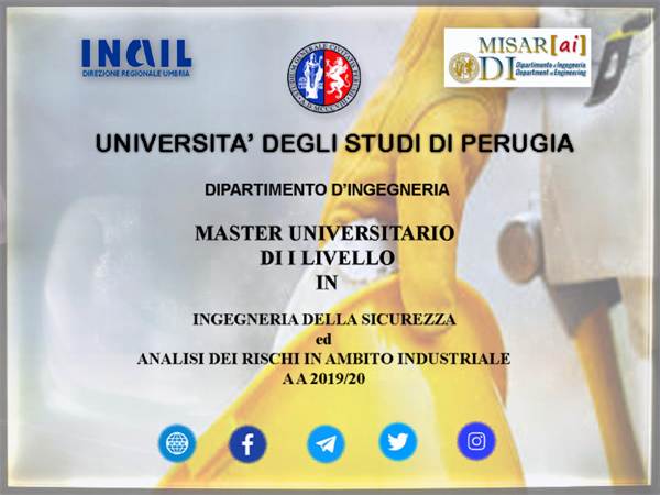
Avviso di riapertura termini - Master in “Ingegneria della sicurezza ed analisi dei rischi in ambito industriale”
Sono riaperti i termini per la presentazione delle domande di ammissione al Master di I livello in...
-
Ciclo di seminari - Prof.ssa Irina Asenova
Nei giorni 22-24 settembre 2025, presso l'Aula Ferdinando Alessandri del Dipartimento di...
-
Seminario “Targeting transient species in ultra-lean flames”
Martedì 16 Settembre 2025, alle ore 16:30, presso l'Aula 13 del Polo di Ingegneria, il Prof....
-
Conferenza “Editorial career and publication with highly impactful journals”
Giovedì 18 settembre, alle ore 15.30, presso l’Aula 7 del Rettorato dell’Università degli Studi di...
-
Team di studenti di Ingegneria Informatica e Robotica alla finale dell’ITADATAhack 2025
Siamo felici di comunicare che, per il terzo anno consecutivo, un team di studenti della nostra...
-
Consegna Open Badge – Formula Student ai membri dell’UniPg Racing Team
Giovedì 10 luglio 2025, nell’Aula Magna del Polo di Ingegneria, si è svolta una cerimonia...
-
Corsi introduttivi 2025
Da lunedì 1 settembre 2025 partono i corsi introduttivi (pre-corsi) organizzati dal Dipartimento di...
-
PhD Day dell’Università degli Studi di Perugia
Il 02/07/2025, in occasione del PhD Day dell’Università degli Studi di Perugia, è stato conferito il...
-
Pubblicato il bando del Dottorato in Ingegneria Industriale e dell’Informazione XLI Ciclo – scadenza 31 luglio
Dal 01/07/2025 al 31/07/2025 sono aperte le iscrizioni per l’ammissione ai corsi di Dottorato di...
-
La sicurezza prima di tutto... e Perugia è su questo “ON THE RIDE”
Si è conclusa ieri la riunione costitutiva del ISO TC 299/WG12 a Boston riguardante i robot con...
-
H2Excellence Thesis Competition 2025: un grande successo guidato dall'Università di Perugia
Il Dipartimento di Ingegneria dell'Università degli Studi di Perugia è lieto di annunciare il grande...
-
Al via la quinta edizione del master in “Ingegneria della sicurezza ed analisi dei rischi in ambito industriale”
Con la pubblicazione del bando ufficiale in data 03/07/2025 da parte dell’Università degli studi...
-
Il Prof. Paolo Carbone ritira il premio Finkelstein 2025
Il 3 luglio 2025 il Prof. Paolo Carbone, docente di Misure elettriche ed elettroniche del nostro...
-
Giornata storica per il Dipartimento di Ingegneria: proclamati i primi laureati in Engineering Management!
Oggi è stata una giornata storica per il Dipartimento di Ingegneria e per l’Università degli Studi di...
-
Seminario “lnspired by nature. Discover and research your own bionic building element”
Date: 30 giugno ore 14:00-17:00, in presenza Aula magna Polo Ingegneria 1 luglio ore 14:00-17:00, in...
-
Seminario “Evolution of Grid Operation and Control”
Data: 20 giugno 2025 ore 10, VIRTUALE
Titolo: Evolution of Grid Operation and Control
Speaker:...
-
Secondo "PhD Workshop" del Dipartimento d'Ingegneria
Siamo lieti di invitarvi al secondo PhD Workshop della Scuola di Dottorato in Ingegneria...
-
Seminario “Dynamic output feedback with adaptive saturation or dead-zone”
Venerdì 16 maggio 2025 alle ore 9:30, nell'Aula 17 del Dipartimento di Ingegneria, Sophie...
-
Trieste Next Academy - Ed. 2025 (Trieste, 26-28 settembre)
Sono aperte le iscrizioni per poter partecipare alla Trieste Next Academy, programma intensivo...
-
Corso di Formazione Permanente e continua in "Efficienza energetica e sostenibilità della Pubblica amministrazione: opportunità, strumenti e metodi di valutazione"
Sono ufficialmente aperte le iscrizioni per l’a.a. 2024/2025 al Corso di formazione permanente e...
-
Seminario “INNOVAZIONE IN AUTOMAZIONE E ROBOTICA”
Venerdì 9 Maggio alle ore 11:30, nell’Aula 3 del Dipartimento di Ingegneria, l'azienda CMC...
-
Seminario “Radar Sensing: Fundamentals, Field Lessons and Ongoing Challenges”
Giovedì 8 maggio 2025 alle ore 14:30, nell'Aula 10 del Dipartimento di Ingegneria, Giordano...
-
Open Day Unipg 2025 - Ingegneria
Quando
9 maggio 2025 dalle ore 8.30 alle ore 18.30
Accesso libero
E' previsto il rilascio di un...
-
UnipgOrientaExpress 2025 - Dipartimento di Ingegneria
Con l’obiettivo di presentare alle future studentesse e ai futuri studenti di UniPg alcune...
-
Seminario “THE GREEN STEEL CHALLENGE – TO BE COMPETITIVE IN THE PRESENT & FUTURE WORLD MARKET”
Martedì 6 Maggio alle ore 14:30, nell’Aula 1 del Dipartimento di Ingegneria, l'azienda Danieli...
-
France Alumni Career Day 2025
La Camera di Commercio Francese in Italia segnala due Career Day che potrebbero essere una bella...
-
Stage extracurriculare – Disegnatore Tecnico (Fratelli Canalicchio S.p.A.)
L'azienda Fratelli Canalicchio di Narni (https://www.canalicchio.com/it-it/) offre una posizione tirocinio...
-
Presentazione dei Corsi di Studio erogati presso il Centro Studi Città di Foligno
Incontro di presentazione dei Corsi di Studio di Laurea Triennale e Magistrale dell’Università di...
-
Seminari di formazione condivisa - I° Ciclo Aprile-Giugno 2025
I ricercatori del CeDiPa hanno organizzato il primo ciclo di Seminari di formazione condivisa, che si...
-
Seminario “Critical Analysis of the Properties of Glazing Systems with Nanosilica Gels”
Mercoledì 9 aprile 2025 alle ore 10.30, nell'Aula Magna del Polo di Ingegneria, la Prof.ssa Mary K....
-
Presentazione nuove Lauree Magistrali - Ingegneria Informazione
Il giorno 10 aprile, dalle ore 16.00 alle 17.30 in aula 4, verranno presentati i nuovi Corsi di...
-
Assegnato il premio Finkelstein 2025 al Prof. Paolo Carbone
L'Institute of Measurement and Control (https://www.instmc.org/default.aspx) è una rete...
-
A Giada Alessandrini il premio per la migliore tesi 2022-23 del Dipartimento di Ingegneria
Giada Alessandrini, nostra ex studentessa, ormai dottoressa magistrale in Ingegneria Meccanica, è...
-
Orientamento PhD - Dipartimento d'Ingegneria
Siamo lieti di invitarvi all'evento Orientamento PhD della Scuola di Dottorato in Ingegneria...
-
Il Prof. Shuji Nakamura ospite al Dipartimento di Ingegneria
Giovedì 20 marzo 2025 abbiamo avuto l'onore di ospitare il Prof. Shuji Nakamura, Premio Nobel per la...
-
Missione in Brasile: nuove opportunità per la collaborazione internazionale
Nei giorni scorsi il direttore Ermanno Cardelli ha visitato quattro importanti università...
-
Lectio Magistralis del Professor Shuji Nakamura
Il 20 marzo 2025, dalle 11:00 alle 13:00, l'Aula Magna di Ingegneria dell'Università degli...
-
A Cristiano Tomassoni il prestigioso titolo di IEEE Fellow
Il Prof. Cristiano Tomassoni, docente di Campi Elettromagnetici presso il Dipartimento di...
-
Treviso Città Impresa Academy (14-16 marzo 2025) - candidature
CITTÀ IMPRESAFESTIVAL DEI TERRITORI INDUSTRIALIEDIZIONE 2025Treviso, 14-16 marzo 2025___
Festival...
-
Seminario “The MST-Ratio: A New Measure of Mixedness for Colorful Point Sets”
Mercoledì 5 febbraio 2025 ore 12 - Sala Alessandri del Dipartimento di Ingegneria
short Bio
Dr....
-
ARVEDI AST- Bando borse di studio CHICCHIERO
Arvedi AST ha indetto il premio di laurea in memoria dell’ingegner Elio Chicchiero, istituendo due borse di...
-
Seminario “Hybrid Dynamical Sistems”
Venerdì 17 gennaio 2025 alle ore 15, nella Sala Alessandri del Dipartimento di Ingegneria, il Prof....
-
Adaptive/Adaptable Systems Engineering (ASE) – Lecture Haifeng Zhu
Venerdì 17 gennaio 2025 in Aula Magna, alle ore 10:30, il Dr. Haifeng Zu, della Boeing, terrà la lecture...
-
OpenUnipg 2025 – Dipartimento di Ingegneria
Martedì 4 febbraio 2025 il Dipartimento di Ingegneria dell’Università degli Studi di Perugia apre...
-
Seminario “PLANNING UNDER UNCERTAINTIES: CLOSED-LOOP SENSITIVITY IN ROBOTIC APPLICATIONS”
Giovedì 19 dicembre 2024 dalle 16.00 alle 17.00 in Aula Magna, il Prof. Andrea Pupa del...
-
Seminario “SLAM AND SENSOR FUSION IN AGRICULTURAL ROBOTS”
Giovedì 19 dicembre 2024 dalle 15.00 alle 16.00 in Aula Magna, il Prof. Matteo Matteucci del...
-
Treviso Città Impresa Academy (14-16 marzo 2025)
CITTÀ IMPRESAFESTIVAL DEI TERRITORI INDUSTRIALIEDIZIONE 2025Treviso, 14-16 marzo 2025___
Sono...
-
Seminario “Il Primo Hackathon TELT, un progetto Binazionale ed Europeo: come la tecnologia e i dati possono supportare la costruzione di infrastrutture sostenibili per affrontare le sfide del cambiamento climatico”
Mercoledì 11 dicembre alle ore 15:00 in AULA MAGNA, si terrà un seminario dal titolo “Il Primo...
-
Seminario “Moto e motori: dallo svago al Racing...”
Lunedì 9 Dicembre - Aula 1 - Ore 14.30-17.30
Nell'ambito dell'Insegnamento di "Motori a...
-
Elezioni Coordinatore del Corso di Laurea Engineering Management
Si comunica che sono indette le elezioni del Coordinatore del Consiglio di Corso di Laurea in...
-
Seminario “L’accreditamento dei laboratori di prova e dei centri del sistema italiano di taratura”
Lunedì 2 Dicembre - Aula D - Ore 14.30-17.30
Nell'ambito dell'Insegnamento di "QUALITY MANAGEMENT",...
-
Seminario “Denoising Diffusion Models: From Theory to Practice in Generative AI”
Martedì 3 dicembre 2024 dalle 12.30 alle 13.30 in Aula 11, in collaborazione con ART SpA (...
-
Seminario “Haptic interaction for human-centered robotics”
Lunedì 2 dicembre alle ore 17:30 in Aula 11, la Dott.ssa Maria Pozzi del Dipartimento di...
-
A Mattia Frattegiani il Premio di Laurea al merito “Riccardo Domenici” XIII Edizione
Si è tenuta giovedì 21 novembre, nell'Aula Magna del Dipartimento di Ingegneria dell’Università degli...
-
Unipg – Ferrari meeting
“La didattica portata in Azienda” stagione 2024-25 sta prendendo forma e portando molti studenti a...
-
Seminario “Evernote: How to Tame an Elephant - Backend Edition”
Mercoledì 4 dicembre alle ore 16:30 in AULA MAGNA, l’azienda Bending Spoons terrà un seminario dal titolo...
-
Opportunità di tirocinio presso MATE
Mate, laboratorio di prove indipendente accreditato da Accredia che opera nei settori Automotive,...
-
Elezione dei Presidenti dei Corsi di Studio dell’Ateneo di Perugia
Il Dipartimento di Ingegneria ha eletto, tra conferme e nuovi ingressi, la squadra dei Presidenti dei...
-
Seminario INGEGNERIA DEL SOFTWARE: "Microservices vs monoliti"
Il 30 ottobre alle ore 17:00 in AULA 10, l’azienda Slope terrà un seminario dal titolo...
-
Seminari di Automatica e Robotica - TECNOLOGIE PER NAVETTE LGV E SISTEMI DI AUTOMAZIONE INDUSTRIALE
Venerdì 25 ottobre, alle 14.30, in aula 11 del dipartimento di Ingegneria, nel quadro delle...
-
EDA Industries incontra gli studenti
Giovedì 24 ottobre 2024 dalle 9:30 alle 11:30, presso l’Aula 8 del Dipartimento di Ingegneria,...
-
Seminario INGEGNERIA DEL SOFTWARE: "Business Applications in the AI Era"
Il 23 ottobre alle ore 17:00 in AULA 10, l’azienda Apsia terrà un seminario dal titolo “Business...
-
Seminario: "The ferromagnetic materials"
Mercoledì 13 novembre alle ore 11:00, nell'aula interna (ex DII), il dr. Carlo Appino dell'INRiM...
-
Borse di Studio CIFI - Bando 2024
Si comunica l’uscita del Bando del COLLEGIO INGEGNERI FERROVIARI ITALIANI per l’assegnazione di...
-
Team di studenti della nostra Laurea Magistrale in Ingegneria Informatica e Roboticafinale alla finale dell’ITADATAhack 2024
Siamo felici di comunicare che un team di studenti della nostra Laurea Magistrale in Ingegneria...
-
Il Polo di Ingegneria si tinge sempre più di rosa
Oggi al Polo di Ingegneria i docenti ed il personale tecnico amministrativo del Dipartimento di...
-
Opportunità di stage presso IPI
IPI Srl, realtà multinazionale del perugino che si occupa di soluzioni per il confezionamento in...
-
UniPg Racing Team in pista per la Formula SAE a Varano de’ Melegari
Il nuovo UniPg Racing Team è sceso in pista per la Formula SAE: a Varano de’ Melegari 1.600...
-
Seed 2024
Dal 25 al 28 settembre si terrà a San Francesco al Prato Seed, un evento di livello...
-
Prof. Paolo Carbone eletto Presidente di IMEKO
Ad agosto 2024 il General Council dell’IMEKO ha eletto come suo Presidente per il prossimo...
-
Cordoglio al Polo di Ingegneria
Cordoglio presso il Polo di Ingegneria ed in particolare al Dipartimento di Ingegneria per la...
-
Elezioni Presidenti Consigli Intercorso/Corso di Laurea
Si comunica che sono indette le elezioni di n. 4 Presidenti di Consiglio di Intercorso/Corso di Laurea –...
-
Scuola Estiva BOOST 24 - BOlogna Orthogonal Summer Term
Sono aperte le iscrizioni per la Summer School “Boost 24” della Fondazione Elicsir.
Per quanti...
-
Corsi introduttivi 2024
Da lunedì 2 settembre 2024 partono i corsi introduttivi (pre-corsi) organizzati dal Dipartimento di...
-
Ingegneria meccanica: premiate le migliori laureate e i migliori laureati triennali e magistrali
L'11 luglio 2024 sono stati premiati i migliori laureati dei corsi di laurea triennale e...
-
Bando di Concorso per le “Migliori Tesi di Laurea Magistrale” A.A. 2022/2023
Bando per l’assegnazione di un attestato di riconoscimento onorifico per le Migliori tesi di laurea...
-
Primo "PhD Workshop" del Dipartimento d'Ingegneria
Siamo lieti di invitarvi al primo PhD Workshop della Scuola di Dottorato in Ingegneria Industriale...
-
Presentazione del Corso di Studi di Laurea Magistrale in INGEGNERIA DELLA SICUREZZA PER IL TERRITORIO E IL COSTRUITO
Seminario di orientamento online: Presentazione del Corso di Studi di Laurea Magistrale in...
-
FA'24 - il Futuro Annunciato
L’evento Il Futuro Annunciato (FA24), che si svolgerà a Orvieto il 5-8 luglio, è rivolto alle...
-
Trieste Next Academy - Ed. 2024 (Trieste, 27-29 settembre)
La 13^ edizione del Festival della Ricerca Scientifica si svolgerà a Trieste dal 27 al 29...
-
Webinar ADDMAG
Lunedì 10 Giugno alle ore 11:00 si terrà un Webinar sulle attività di ricerca del progetto PRIN...
-
Workshop "Dall’emergenza al metodo: protezione civile e sicurezza - Il rischio da incendi boschivi”
II Giornata di studi “Dall’emergenza al metodo: protezione civile e sicurezza – Il rischio da...
-
France Alumni Career Day
La Camera di Commercio Francese in Italia segnala due Career Day che potrebbero essere una bella...
-
M. C. Valigi eletta nella Giunta di IFToMM sez.Italia
La Prof.ssa Maria Cristina Valigi docente di Meccanica Applicata alle Macchine presso il...
-
Seminario: "4D Cameras"
Si avvisano tutti gli studenti che il giorno giovedì 16 maggio 2024 alle 16:30 nell’aula 11 del...
-
C’è anche UniPG dietro le montagne russe più alte e veloci del mondo Top Thrill 2
C’è anche L’Università degli Studi di Perugia dietro alla montagna russa a triplo lancio più alta...
-
UnipgOrientaExpress 2024 - Dipartimento di Ingegneria
Con l’obiettivo di presentare alle future studentesse e ai futuri studenti di UniPg alcune...
-
Orientamento alle Lauree Magistrali in "Ingegneria Elettronica per l'IoT" e in "Ingegneria Informatica e Robotica"
Il giorno 8 maggio 2024, nell'orario 17:15-18:30, presso l'aula 4 del Dipartimento di...
-
Seminario Synergie CAD - Il ruolo del test nell’evoluzione dei semiconduttori
Si avvisano tutti gli studenti che il giorno lunedì 6 maggio 2024 alle 16:30 nell’aula 3 del...
-
Seminario: "Filters role in mobile products and impact of 5G"
Venerdì 3 maggio alle ore 11:30, nell'Aula 4 del Dipartimento di Ingegneria, Erika Meniconi terrà un...
-
Seminario: "Demystifying VNA: Introduction into network analysis and calibration"
Martedì 23 aprile alle ore 8:30, nel Laboratorio multidisciplinare del Dipartimento di...
-
Open Day Unipg 2024 - Ingegneria
Quando
18 - 19 aprile 2024
Locandina
Accesso libero
E' previsto il rilascio di un attestato di...
-
Festività pasquali - Chiusura Dipartimento
Si informa che per uniformarci alla sede centrale in occasione delle festività pasquali il...
-
Seminario: "The Bend-Minimization Problem in Orthogonal Graph Drawing"
Mercoledì 20 marzo alle ore 14.30 il Prof. Giuseppe Liotta terrà il seminario dell'iniziativa La...
-
Seminario: "Additive Manufacturing: emerging opportunities for microwave components"
Docente: Cristiano Tomassoni
Luogo: Sala Ferdinandidata: 26 marzo 2024 ora 11:00
Titolo: Additive...
-
Seminario: "Integrated Electronic Mixed-Signal Circuits: from the idea to the chip"
Martedì 26 marzo alle ore 14:30, nell'Aula 11 del Polo di Ingegneria, nell’ambito...
-
OpenIng - Il Polo di Ingegneria apre le porte agli studenti delle scuole superiori
Stai per terminare la scuole superiori e sei interessata/o a un percorso di studi in ingegneria?...
-
Premio "Most promising researcher in robotics and artificial intelligence”
La Fondazione Mondo Digitale ETS, in occasione della RomeCup 2024, promuove con l’Università...
-
Corso "ARTIFICIAL INTELLIGENCE FOR AFFECTIVE COMPUTING"
Giovedì 29 febbraio 2024Aula A3 Dipartimento di Matematica e Informatica - Università di...
-
Corso di Formazione Permanente e continua in "Efficienza energetica e sostenibilità della Pubblica amministrazione: opportunità, strumenti e metodi di valutazione"
Sono aperti i termini per la presentazione delle domande di ammissione al Corso di formazione...
-
Cristiano Tomassoni nominato Distinguished Microwave Lecturer (DML) di IEEE
Il Prof. Cristiano Tomassoni, docente di Campi Elettromagnetici presso il Dipartimento di...
-
Elezione rappresentanti studenti Commissione Paritetica del Dipartimento di Ingegneria - 2024
Indizione per il giorno 7 febbraio 2024 delle votazioni per l'elezione dei rappresentanti degli studenti...
-
Cerimonia conclusiva Master di II livello in Management dei processi sanitari II Edizione a.a. 20/21
Venerdì 2 febbraio alle ore 15:00 presso l’Aula Magna del Polo di Ingegneria si terrà la...
-
Visita del Direttore nelle principali Università tecniche del Sudafrica
Nei giorni scorsi il prof. Ermanno Cardelli, Direttore del Dipartimento di Ingegneria, ha...
-
Materiali metallici per l’aeronautica: giornata di studio alle Fucine Umbre
Mercoledì 31 gennaio ore 9 sede Fucine Umbre via del Sersimone, 22 - Terni
Incentivare la...
-
Progetto CoopStartUp Umbria
Coopstartup Umbria è un’iniziativa che ha l’obiettivo di accompagnare lo sviluppo di idee...
-
Microwave Photonics: an Introduction - Ciclo lezioni
Ciclo di lezioni tenute dal
Prof. Maurizio BURLA,Technical University of BerlinERC Starting Grant...
-
Primo seminario del Centro di Ricerca Interdipartimentale "L. Cesari"
Mercoledì 29 novembre alle ore 16:00 in aula A3 del Dipartimento di Matematica e Informatica il Prof....
-
Seminari per studenti/ricercatori tecnologie elettrochimiche - Progetto StoRIES
Nell'ambito del progetto europeo StoRIES sono stati organizzati i 4 seminari con l'obiettivo di...
-
Ad Alessandro Eugeni il Premio di Laurea al merito “Riccardo Domenici” XII Edizione
Si è tenuta venerdì 24 novembre, nell'Aula Magna del Dipartimento di Ingegneria dell’Università degli...
-
Seminario: "Modelling and experimental characterization of classic and new magnetic materials"
Giovedì 23 novembre alle ore 11:30 in aula ex DII il dr. Fabien Sixdenier (Laboratoire AMPERE -...
-
I vincitori dei premi di laurea “Pegaso 2000”
Pegaso 2000 e Università degli Studi di Perugia in partnership premiano l’innovazione delle tesi...
-
Co-design e flusso di progettazione su SOC
Mercoledì 15, 22, 29 novembre e 6 dicembre 2023 10:30-13:30, Laboratorio Multidisciplinare del...
-
Giornata Studio dell’Assocazione Italiana di Metallurgia
L’Associazione Italiana di Metallurgia (AIM) insieme al Dipartimento di Ingegneria...
-
Seminario: "Bringing AI to Production"
Il 15 novembre, l’azienda Bending Spoons terrà un seminario dal titolo “Bringing AI to...
-
Roadshow - Telespazio incontra gli studenti
La società Telespazio propone un bando per la partecipare di studenti, dottorandi/ti e ricercatori al...
-
Qorvo incontra UniPG: elettronica dall'aerospazio al consumer
Martedì 7/11/2023, in Aula 4, dalle 14:30 alle 16:30, il Dipartimento di Ingegneria ospiterà...
-
Inaugurazione Anno Accademico 2023/2024
Il Magnifico Rettore, Prof. Maurizio Oliviero, ha inaugurato nella mattina del 25 ottobre 2023,...
-
Seminario: "La pubblicazione scientifica e il suo valore per il ricercatore e per l'istituzione"
Nell’ambito delle attività formative del Dottorato in Scienze Giuridiche del Dipartimento di...
-
Seminario INFN Perugia - NEGHEP
Martedì 24/10/202316:30 - 17:30, Aula 8, Triennio
Negative Capacitance Field Effect Transistors...
-
Infineon Technologies incontra UniPG: dal Chips-Act all'Ingegneria - Seminario
Martedì 10/10/202314:30 - 16:30, Aula 4, Triennio
"Infineon Technologies incontra UniPG: dal...
-
Lectio Magistralis "Portable Radar Systems at the Human-Microwave Frontier: Life Activity Sensing and Human Tracking"
Siamo orgogliosi di annunciare che su invito del IEEE MTT-S / AP-S Italy Chapter - Central and...
-
Chiusura parcheggio studenti Polo Ingegneria
Si comunica agli studenti e a tutto il personale del Polo di Ingegneria che da Lunedì 2 ottobre...
-
Corso di statistica non parametrica Bayesiana
Nei giorni 26 Settembre, 3 e 10 Ottobre, presso il Dipartimento di Economia del nostro Ateneo, si...
-
Seminario: "Artificial intelligence-enabled Smart Structural Health Monitoring and Maintenance of Civil Infrastructure"
Nell’ambito del Corso di Dottorato Internazionale e Industriale in “Civil and Environmental...
-
UniPG in finale all’ITADATAhack 2023
Siamo felici di comunicare che due team di studenti della nostra Laurea Magistrale in Ingegneria...
-
Ingegneria-UniPg nella stratosfera col satellite Cuballoon
La piattaforma Cubesat “Cuballoon” è uno dei prodotti dell'accordo di collaborazione tra l'Agenzia...
-
Seminario "State-of-the-art millimeter-wave circuit design and testing at STMicroelectronics" - STMicroelectronics
TECHNICAL SEMINAR
Dr. Joao Azevedo Goncalves of STMicroelectronics, Crolles, France, will give a...
-
Corsi introduttivi 2023
Da lunedì 4 settembre 2023 partono i corsi introduttivi (pre-corsi) organizzati dal Dipartimento...
-
Premiazione migliori tesi magistrali iEdu
Giovedì 13 luglio sono state premiate le migliori tesi magistrali sviluppate nell'ambito del...
-
Premiazione migliori laureati dei percorsi in Ingegneria Meccanica dell'A.A. 2021-2022
Giovedì 13 luglio sono stati premiati i migliori laureati dei percorsi in Ingegneria Meccanica,...
-
Bando di concorso per le "Migliori tesi di laurea magistrale" discusse nell'anno accademico 2021/2022
L’Università degli Studi di Perugia ha indetto un bando per l’assegnazione di un attestato di...
-
Career Day UNIPG - I giovani incontrano il lavoro - 13 giugno 2023
Il Servizio Job Placement di Ateneo organizza il Career Day Unipg 2023, un incontro rivolto a...
-
Presentazione CdS Ing della Sicurezza - Foligno
Giovedì 8 giugno 2023 presso la sede didattica del Centro Studi Città di Foligno, alle ore 11:30,...
-
Seminario: "SENSORS CONTROL AND MONITORING APPLICATIONS IN AEROSPACE"
Venerdì 26 maggio alle ore 16:30, nell'Aula 11 del Polo di Ingegneria, Francesco Raspolli (Head of Design...
-
Dottorato congiunto fra il nostro Ateneo e la VUB di Bruxelles - Esame finale
In seguito a un dottorato congiunto fra il nostro Ateneo e la VUB di Bruxelles, il 14 giugno 2023...
-
Conclusione seconda edizione di Situm
Sabato 20 maggio l’Abbazia di Sant’Urbano, ad Apiro (MC), ha ospitato la cerimonia di passaggio,...
-
Seminario “Analisi del comportamento di opere geotecniche dai dati di monitoraggio”
Giovedì 11 maggio alle ore 11:00 presso Centro Studi di Foligno, si terrà il seminario “Analisi del...
-
IEEE ComSoc Student Recruitment Event - ICC 2023 Roma
ComSoc ha organizzato la prima IEEE Communications Society Career Fair del 2023, che si terrà...
-
ABB E-mobility Discovery Day
Il giorno mercoledì 31 maggio dalle ore 9:30 alle 13:00 nella sede di ABB E-Mobility a San...
-
Seminario: "Integrated Electronic Mixed-Signal Circuits: from the idea to the chip"
Venerdì 19 maggio alle ore 14:30, nell'Aula 11 del Polo di Ingegneria, nell’ambito...
-
Open Day UniPG
L’Università degli Studi di Perugia è lieta di invitarvi alla presentazione della propria offerta formativa di...
-
Seminari di Automatica e Robotica - CONTROLLO PID NELLA TERMOREGOLAZIONE FUNZIONI E HANDS ON APPLICATIVI
Nel quadro del ciclo di "Seminari di Automatica e Robotica", organizzato dal gruppo di Automatica del...
-
Workshop “RootS23 - SOIL-PLANT-ATMOSPHERE INTERACTION: MECHANISMS, PROCESSES AND GEOTECHNICAL ENGINEERING IMPLICATIONS”
Thursday 20th - Friday 21st April 2023 PERUGIA, Italy Department of Engineering, University of...
-
Seminario "Le nuove sfide dell’Intelligenza Artificiale" - Prof. G. F. Italiano
In occasione dell'Inaugurazione della IX edizione del Master in Data Science, che si tiene il...
-
Seminari di Automatica e Robotica - Fundamentals of Unmanned Aerial Systems designal intelligence
Nel quadro del ciclo di "Seminari di Automatica e Robotica", organizzato dal gruppo di Automatica del...
-
Premio Mariani 2023 a Jacopo Cancellieri
Jacopo Cancellieri, un nostro ex-studente del corso di Laurea Magistrale in Ingegneria...
-
Seminari di Automatica e Robotica - How to face global challenges? The role of natural computing and chemical artificial intelligence
Nel quadro del ciclo di "Seminari di Automatica e Robotica", organizzato dal gruppo di Automatica del...
-
Premi di Laurea "Pegaso 2000" per le migliori tesi su argomenti legati ai temi dell'Ingegneria informatica - IV^ Edizione
La nostra Università, in collaborazione con Pegaso 2000 S.r.l., bandisce un concorso per...
-
Control System Techniques in Aerospace and Smart Grids
Il Collegio del DOTTORATO in INGEGNERIA INDUSTRIALE e DELL'INFORMAZIONE ha organizzato per il...
-
UniPgOrientaExpress 2023 - Dipartimento di Ingegneria
DAL 1 AL 28 FEBBRAIO 2023
Viaggio di orientamento per studenti delle classi IV e V delle Scuole...
-
CyberChallenge.IT - Iscrizioni
Sono aperte le iscrizioni alla prossima edizione del programma CyberChallenge.IT....
-
Valentina Palazzi nominata segretario IEEE Microwave Theory and Technology
Valentina Palazzi, docente presso il Dipartimento di Ingegneria del Studi di Perugia, è stata...
-
Festa per il pensionamento del Prof. Conti
Venerdì 13 gennaio abbiamo salutato con una bella ed informale cerimonia il Prof. Paolo Conti,...
-
Siamo Dipartimento di Eccellenza!
Il MUR ha pubblicato sul proprio sito istituzionale l’elenco dei complessivi 180 Dipartimenti di...
-
Progetto Regenia - Seminario 13 gennaio 2023 - ore 16.00
Nel quadro del progetto Regenia, venerdì 13 gennaio 2023 alle ore 16.00, si terrà il seminario...
-
Accademia Digitale Integrata Industria 4.0
Cari ragazzi, anche Schneider Electric, azienda multinazionale che guida la trasformazione...
-
INGEGNERIA tra i Dipartimenti di Eccellenza 2023 - 2027
Il nostro Dipartimento è stato ammesso ai finanziamenti per i Dipartimenti di Eccellenza 2023 - 2027....
-
Interazioni Fluido-Struttura su Paracadute per Sistemi di Rientro a Terra - Seminario
Giovedì 22 Dicembre alle 10:30, nell'Aula Magna del Polo di Ingegneria, verrà presentato un...
-
Evento RAI - Dipartimento di Ingegneria
Nell’ambito della Convenzione di Ricerca tra il nostro Dipartimento e la RAI, Giovedì 15 Dicembre alle...
-
Seminario Huawei Italia - R&D center Milano
Nell'ambito dell'insegnamento di "Progettazione di Circuiti Integrati a Radiofrequenza" si terrà, in...
-
Votazioni delle rappresentanze della Giunta di Dipartimento - Triennio Accademico 2022/2025 - Proclamazione definitiva
Le votazioni per l'elezione dei componenti della Giunta del Dipartimento di Ingegneria per il...
-
3° Giornata di Studio sui Motori a Combustione Interna
Patrocinata da AIMSEA (Associazione Italiana delle Macchine a fluido e dei Sistemi per l'Energia e...
-
Accordo di Doppio Titolo con Technical University of Ostrava
Stipulato un accordo per il rilascio di Doppio Titolo tra la Laurea Magistrale in "Ingegneria della...
-
Elezioni Coordinatore del Corso di Laurea Engineering Management - Proclamazione definitiva
Le elezioni del Coordinatore del Consiglio di Corso di Laurea in Engineering Management per il...
-
Indizione votazioni delle rappresentanze della Giunta di Dipartimento - Triennio Accademico 2022/2025
Le votazioni per l'elezione dei componenti della Giunta del Dipartimento di Ingegneria per il...
-
A Giacomo Massini e Francesco Pieroni il Premio di Laurea al merito “Riccardo Domenici” XI Edizione
Si è tenuta ieri, mercoledì 25 ottobre, nell'Aula Magna del Dipartimento di Ingegneria...
-
“MLOps: modern distributed infrastructure for model serving” - Seminario
Mercoledì 16 Novembre, alle 16:30 in AULA 10, l’azienda Bending Spoons terrà un seminario su...
-
Software MathWorks / Matlab - Presentazione & Materiale informativo
L’Università degli Studi di Perugia ha siglato un contratto con MathWorks che consente a tutti...
-
Indizione elezioni per il rinnovo delle rappresentanze del personale tecnico amministrativo nel Consiglio di Dipartimento - Triennio Accademico 2022/2025 - Eletti
Le votazioni per l'elezione di n. 13 rappresentanti del personale tecnico amministrativo nel...
-
Elezioni Coordinatore del Corso di Laurea Engineering Management
Si comunica che sono indette le elezioni del Coordinatore del Consiglio di Corso di Laurea in...
-
Developing rate-rate digital twins for structures under shock loading
Il Collegio del DOTTORATO in INGEGNERIA INDUSTRIALE e DELL'INFORMAZIONE ha organizzato per il...
-
Fatigue Analysis by Finite Element Method and multi-paradigm programming language (MATLAB)
Il Collegio del DOTTORATO in INGEGNERIA INDUSTRIALE e DELL'INFORMAZIONE ha organizzato per i...
-
Festival Città Impresa - Bergamo, 17-20 novembre 2022
BERGAMO CITTÀ IMPRESAFESTIVAL DEI TERRITORI INDUSTRIALIEDIZIONE 2022 Bergamo, 17-20 novembre 2022___...
-
Lezioni di supporto per matricole A.A. 2022/2023
Il Dipartimento di Ingegneria ha organizzato delle Lezioni di supporto destinate alle nuove...
-
Indizione elezioni per il rinnovo delle rappresentanze del personale tecnico amministrativo nel Consiglio di Dipartimento - Triennio Accademico 2022/2025 - Candidature
Le votazioni per l'elezione di n. 13 rappresentanti del personale tecnico amministrativo nel...
-
Artificial Intelligence for Wind Turbine Condition Monitoring and Structural Health Monitoring
Il Collegio del DOTTORATO in INGEGNERIA INDUSTRIALE e DELL'INFORMAZIONE ha organizzato per il...
-
Elezioni del Direttore del Dipartimento - Proclamazione definitiva
Le votazioni per l'elezione del Direttore del Dipartimento di Ingegneria per il triennio...
-
MagistraLMente Unipg 2022 - Dipartimento di Ingegneria
Il 23 e il 26 settembre 2022 si svolgeranno gli open day dei corsi di laurea magistrali del...
-
Galileo Festival Academy: il bando per l'edizione 2022 (Padova, 13-16 ottobre)
L'edizione 2022 della Galileo Festival Academy, programma intensivo che offre agli studenti...
-
Elezioni del Direttore del Dipartimento - Proclamazione provvisoria
Le votazioni per l'elezione del Direttore del Dipartimento di Ingegneria per il triennio...
-
Corsi introduttivi 2022
Da lunedì 5 settembre a TERNI e da martedì 6 settembre a PERUGIA partono i corsi introduttivi...
-
Indizione elezioni per il rinnovo delle rappresentanze del personale tecnico amministrativo nel Consiglio di Dipartimento - Triennio Accademico 2022/2025
Le votazioni per l'elezione di n. 13 rappresentanti del personale tecnico amministrativo nel...
-
Borse di soggiorno per Trieste Next - Ed. 2022 (Trieste, 22-24 settembre)
La undicesima edizione del Festival della Ricerca Scientifica si svolgerà a Trieste da giovedì 22...
-
Progetto STEAM-Active
L’Università degli Studi di Perugia, tramite il coinvolgimento del Dipartimento di Ingegneria, è...
-
Premio “Giuseppe Taliercio” - 2022
Sono aperte le candidature per l'assegnazione di tre premi di laurea per tesi di laurea magistrale sul...
-
Indizione Elezioni del Direttore del Dipartimento - Candidatura
Le votazioni per l'elezione del Direttore del Dipartimento di Ingegneria per il triennio...
-
Contest Automotive
Il Designer romano Boris Fabris, che alcuni dei nostri studenti hanno avuto modo di conoscere (...
-
L’alta formazione e il mercato del lavoro
"Il Dottorato si presenta" - Presentazione Dottorato e le sue declinazioni per l’industria Foto...
-
HSE Management Summer School 2022 - VSB-TU Ostrava
È di imminente uscita il bando per l’assegnazione di contributi di mobilità ai fini della...
-
Ingegneria Meccanica - Premiazione "Miglior laureato 2020/2021"
L'ultima seduta di Laurea dei laureandi triennali e magistrali in Ingegneria Meccanica, che si è svolta...
-
"Il Dottorato si presenta" - Dipartimento di Ingegneria
Evento 15/06/2022
Il 15 giugno alle 10 in Aula Magna il Dipartimento di Ingegneria organizza un...
-
Evento RAI - Dipartimento di Ingegneria
Nell’ambito della Convenzione di Ricerca tra il nostro Dipartimento e la RAI, Martedì 14 Giugno, alle...
-
Master in Management dei Processi Sanitari - Seminario prof. Prattichizzo
Venerdì 10 Giugno 2022 alle ore 11 presso l’Aula 1 del Polo di Ingegneria il prof. Domenico...
-
Indizione Elezioni del Direttore del Dipartimento
Le votazioni per l'elezione del Direttore del Dipartimento di Ingegneria per il triennio...
-
Workshop_Sostenibilità, innovazione, occupazione
Venerdì 27 maggio 2022 alle ore 10:00 - 12:00, presso l'Aula Magna del Polo di Ingegneria (Via G....
-
Seminari di Automatica e Robotica - Hybrid control of self-oscillating resonant converters
Il prossimo incontro del ciclo di "Seminari di Automatica e Robotica", organizzato dal gruppo di...
-
Il mondo della Cybersecurity non è solo IT: L'importanza di OT e (I)IOT
Il Collegio del DOTTORATO in INGEGNERIA INDUSTRIALE e DELL'INFORMAZIONE ha organizzato per il...
-
HSE Management Summer School 2022 - VSB-TU Ostrava
Summer School sul tema Health Safety Environment presso la Faculty of Safety Engineering,...
-
OPEN DAY on-line Dipartimento di Ingegneria
Giovedì 19 Maggio dalle ore 14:30 si svolgerà sulla piattaforma Zoom l'OPEN DAY on-line del...
-
PROTEZIONE SISMICA A SCALA URBANA – Seminario
Venerdì 13 maggio alle ore 10:30 si terrà il seminario:
PROTEZIONE SISMICA A SCALA URBANA.LA...
-
Faist, Makor e Tiberina incontrano gli studenti di Ingegneria
Il 20 maggio, dalle ore 14:30 in Aula A, nell’Edificio del Biennio, presso il Polo di Ingegneria...
-
On the tracksof elementary particles
Il Collegio del DOTTORATO in INGEGNERIA INDUSTRIALE e DELL'INFORMAZIONE ha organizzato per il...
-
IEEE MTT-S Distinguished Microwave Instructors - Webinar
Cristiano Tomassoni e Paolo Mezzanotte segnalano un webinar organizzato dalla società Microwave...
-
Seminari di Automatica e Robotica - From constraints to opportunities: efficient visual task learning for humanoid robotics
Il prossimo incontro del ciclo di "Seminari di Automatica e Robotica", organizzato dal gruppo di...
-
Human and robotic hands
Il Collegio del DOTTORATO in INGEGNERIA INDUSTRIALE e DELL'INFORMAZIONE ha organizzato per il...
-
Training Fully Connected Neural Networks is ∃R-Complete
Il Collegio del DOTTORATO in INGEGNERIA INDUSTRIALE e DELL'INFORMAZIONE ha organizzato per il...
-
Pubblicato su Youtube il video della giornata di Orientamento Open Day live 2022 del Dipartimento di Ingegneria
Il video della giornata di Orientamento Open Day live 2022 del Dipartimento di Ingegneria è stato...
-
Proposta di Tirocinio (STAGE) per Data engineer presso Aboca
DATA ENGINEER - STAGE
Aboca è una healthcare company italiana che si occupa di cura della salute...
-
Due seminari nell'ambito delle attività del CdS in Ing. della Sicurezza - e dell'insegnamento di "Sicurezza Geotecnica"
AVVISO IMPORTANTE: Si comunica che il seminario "LA SICUREZZA NEI GRANDI TRAFORI ALPINI - Ing....
-
Elezione rappresentanti studenti Commissione Paritetica del Dipartimento di Ingegneria
Indizione per il giorno 5 aprile 2022 delle votazioni per l'elezione dei rappresentanti degli...
-
OPEN DAY del Dipartimento di Ingegneria | UnipgOrientaLive (5 aprile ore 15:00 - 16:30)
Martedì 5 aprile dalle ore 15:00 alle ore 16:30 si svolgerà sulla piattaforma Zoom l'OpenDay...
-
Open Day UNIPG 2022
Dal 28 marzo al 4 aprile 2022 si svolgerà una serie di giornate di presentazione dei corsi di...
-
Azienda di Perugia cerca Electronic and PLC Software Engineer
Job posting: Electronic and PLC Software Engineer (Primatech Srl - San Sisto, Perugia)
Mansioni:...
-
Takeda Pharmaceutical cerca ingegneri per lo stabilimento di Rieti.
Takeda Pharmaceutical è alla ricerca di due neolaureati con un profilo sui sistemi informativi...
-
Bando 2022 - Premi di Laurea "Pegaso 2000" per le migliori tesi su argomenti legati ai temi dell'Ingegneria informatica e tecnologie digitali" - III^ edizione
La nostra Università, in collaborazione con Pegaso 2000 S.r.l., bandisce un concorso per l'attribuzione di n.3...
-
1^ Giornata di Studio di Ateneo sull’Idrogeno
L’idrogeno può diventare la chiave di volta della transizione ecologica? L’Ateneo si confronta sul tema...
-
Elezioni Presidente Consiglio di Corso di Laurea in Ingegneria della Sicurezza per il territorio e il Costruito
Si comunica che sono indette le elezioni del Presidente del Consiglio di Corso di Laurea in...
-
UniPgOrientaExpress - Dipartimento di Ingegneria
DAL 24 GENNAIO 2022 AL 24 FEBBRAIO 2022
Viaggio di orientamento per studenti delle classi IV e V...
-
Siemens Accademia Digitale - Edizione 2022
Sta per partire la quinta edizione di Siemens Accademia Digitale, il percorso interamente online...
-
Inaugurazione II edizione del Master in Management dei Processi Sanitari
Il 14 gennaio 2022 alle ore 11.30 presso l’Aula Magna del Polo di Ingegneria si terrà...
-
iEDU: personalizza il percorso di studi con attività extracurriculari di alta formazione
Al via il ciclo di seminari e workshop gratuiti del programma #iEDU (download), un’iniziativa...
-
Progetto iEDU - Grand Challenges Scholar Program
In sinergia con il programma GCSP, il Dipartimento promuove il progetto iEDU (con il sostegno...
-
Seminari di Automatica e Robotica: Hybrid dynamical systems
Il secondo incontro del ciclo di "Seminari di Automatica e Robotica", organizzato dal gruppo di Automatica...
-
Red Bull e la Scuderia AlphaTauri al Dipartimento di Ingegneria - L’Ateneo conferma il suo contributo scientifico al mondo dei motori
Venerdì 26 novembre 2021 atmosfera da Formula 1 al Dipartimento di Ingegneria dell’Università...
-
Seminario Omron Electronics - AMR Autonomous Mobile Robot
Omron Electronics, in collaborazione con l'Università degli Studi di Perugia, organizza un...
-
Seminari di Automatica e Robotica: Boundary control design for a class of distributed parameter systems
Nel quadro del ciclo di "Seminari di Automatica e Robotica", lunedì 29 novembre, alle ore 15.00,...
-
Red Bull Italia porta la Scuderia AlphaTauri al Polo di Ingegneria
L’Ing. Johann Richter parlerà dei motori ibridi in Formula 1
A lezione di Formula 1 con Red Bull e il...
-
Seminario IC Mask Design, Ireland, Italy - Insegnamento Progetto di circuiti integrati CMOS su scala nanometrica
L’IC Mask Design, Ireland & Italy, in collaborazione con il Dipartimento di Ingegneria...
-
Seminario – FPGA Development for Physics in Space
L'Istituto Nazionale di Fisica Nucleare, in collaborazione con il Dipartimento di Ingegneria...
-
Seminario – Electromechanical Actuation in Aerospace Industry
L'azienda OFFICINE MECCANICHE AREONAUTICHE S.P.A. (OMA), in collaborazione con il Dipartimento di...
-
Seminario – Sistemi Elettronici Embedded per applicazioni Avioniche e Testing
L'azienda CBL ELECTRONICS, in collaborazione con il Dipartimento di Ingegneria dell'Università degli Studi...
-
Seminario – Model-based design techniques based on FPGA
L'azienda XIBO Engineering Solutions, in collaborazione con il Dipartimento di Ingegneria...
-
A Annalisa Belia il Premio di Laurea al merito “Riccardo Domenici” X Edizione
Si è tenuta ieri, giovedì 28 ottobre, nell'Aula A del Dipartimento di Ingegneria dell’Università degli...
-
Seminario NEGHEP – Negative Capacitance Field Effect Transistors for the future High Energy Physics applications
L’Istituto Nazionale di Fisica Nucleare – Sezione di Perugia, in collaborazione con il...
-
Roberto Zullo ha vinto il Premio UCIMU, prestigioso riconoscimento per l'ingegneria industriale
Il dottor Roberto Zullo, laureato del corso di laurea Specialistica in Ingegneria Meccanica del...
-
"L'energia delle donne: la transizione energetica spiegata dalle donne che ne guidano il cambiamento" - Seminario
L'Azienda Baker Hughes (ex General Electrics) organizza un seminario dal titolo "L'energia delle...
-
Gianluca Reali riceve il premio “Partner of the Year 2021 – Talent Alliance”
L’Università degli Studi di Perugia è stata insignita del riconoscimento “Partner of the Year...
-
Ingegneria Informatica ed Elettronica - Lezioni di supporto per matricole - 2^ parte
Proseguono le lezioni di supporto per le matricoledel corso di Ingegneria Informatica ed...
-
La studentessa Lucia Celeschi e il professor Fabio Radicioni di Unipg partecipano a Mare Aperto 2021, esercitazione della Marina Militare Italiana
Lucia Celeschi e il professor Fabio Radicioni, rispettivamente studentessa e Ordinario del Corso...
-
Valentina Palazzi è la nuova "Early Career Representative" della commissione D - "Electronics and Photonics" dell'URSI
Valentina Palazzi, docente del Dipartimento di Ingegneria, è stata eletta “Early Career...
-
Digitalizzazione industriale: case study OMA
Il Collegio del DOTTORATO in INGEGNERIA INDUSTRIALE e DELL'INFORMAZIONE ha organizzato per il...
-
MiniMaster Introductory in Project Management – 4^ Ed.
Sono aperte le registrazioni alla quarta edizione del:
MINIMASTER INTRODUCTORY IN PROJECT...
-
Premio Miglior Giovane Ricercatore Italiano in Informatica Teorica a Fabrizio Montecchiani
Il Capitolo Italiano dell'European Association for Theoretical Computer Science (EATCS) ha...
-
Ingegneria Informatica ed Elettronica - Lezioni di supporto per matricole
Il corso di Ingegneria Informatica ed Elettronicaorganizza lezioni di supporto per le matricole...
-
Inizio Lezioni A.A. 2021-2022
Il 20 settembre 2021 ripartono in sicurezza, nel rispetto dei protocolli anti COVID19 definiti...
-
Elezione rappresentanti personale tecnico amministrativo nel Consiglio di Dipartimento
Indizione per il giorno 20 settembre 2021 delle votazioni per l'elezione di n. 1 rappresentante del...
-
Corsi introduttivi 2021
Da mercoledì 8 settembre partono i corsi introduttivi organizzati dal Dipartimento e rivolti alle matricole...
-
INDIZIONE delle votazioni per le elezioni del Presidente del Consiglio Intercorso - Ingegneria Meccanica
Si comunica che sono indette le elezioni del Presidente del Consiglio di Intercorso di Laurea in...
-
INDIZIONE votazioni elezione presidente consiglio intercorso di Laurea in Ingegneria Industriale (TERNI)
Si comunica che con Decreto n. 4 del 30 Giugno 2021 sono indette le elezioni del Presidente del Consiglio...
-
INDIZIONE votazioni elezione Presidente Consiglio Intercorso Ingegneria dell'Informazione - DD 93/2021
Si comunica l'indizione delle votazioni per l'elezione del Presidente del Consiglio di Intercorso...
-
Texture and colour descriptors for visual recognition: an overview of methods applications
Il Collegio del DOTTORATO in INGEGNERIA INDUSTRIALE e DELL'INFORMAZIONE ha organizzato per il...
-
MagistraLMente Unipg - Dipartimento di Ingegneria
Il 5 luglio 2021 si svolgeranno gli open day dei corsi di laurea magistrali del Dipartimento di...
-
Risk and territorial resilience
Il Collegio del DOTTORATO in INGEGNERIA INDUSTRIALE e DELL'INFORMAZIONE ha organizzato per il...
-
Ciclo di Seminari di Dottorato 2021-2022
Il Collegio del DOTTORATO in INGEGNERIA INDUSTRIALE e DELL'INFORMAZIONE organizza un ciclo di...
-
Additive Manufacturing - processes and optimization for aeronautical equipment
Il Collegio del DOTTORATO in INGEGNERIA INDUSTRIALE e DELL'INFORMAZIONE ha organizzato per il...
-
Baker Hughes incontra l'Università degli studi di Perugia: un'alleanza per la Sostenibilità
Link al meeting
Martedi 25 Maggio ore 15:00 Piattaforma Teams
Introduzione a Baker Hughes e alle...
-
Robotics and Haptics: a Wearable Perspective
Il Collegio del DOTTORATO in INGEGNERIA INDUSTRIALE e DELL'INFORMAZIONE ha organizzato per il...
-
Safe, Sustainable and Low-cost Electromagnetic Technologies for the Internet of Things
Il Collegio del DOTTORATO in INGEGNERIA INDUSTRIALE e DELL'INFORMAZIONE ha organizzato per il...
-
Seminari aziendali - Orientamento Magistrale
Il Dipartimento di Ingegneria dell'Università degli Studi di Perugia, nell'ambito delle attività...
-
Presentazione Lauree Magistrali - Orientamento Magistrale
Il Dipartimento di Ingegneria dell'Università degli Studi di Perugia, nell'ambito delle attività...
-
Elezioni del Presidente del Consiglio di Corso di Studio di Ingegneria Industriale - sede di Terni
Si comunica che ieri, 31 Marzo 2021, a seguito delle votazioni per l'elezione del Presidente del...
-
OPEN DAY del Dipartimento di Ingegneria | UnipgOrientaLive (15 aprile ore 14:30)
Giovedì 15 aprile dalle 14:30 si svolgerà in diretta streaming l'OpenDay UnipgOrientaLive del...
-
Borsa di studio di €2.000 per studenti di Economia e Ingegneria Gestionale - Net Economy’s Got Talent
FairOne S.p.A, società a cui fa capo il servizio online MutuiSupermarket.it, motore di ricerca e...
-
First Ascent 2021. L'evento di Bending Spoons per promuovere l’eccellenza in campo accademico
Torna anche quest’anno la prestigiosa selezione lanciata da Bending Spoons per valorizzare i...
-
Francesco Bianchi premiato con il 2020 CMS award
L’ingegner Francesco Bianchi, Ricercatore del Dipartimento di Fisica e Geologia dell’Università di...
-
Le sfide del futuro: Ingegneria a Terni
Ingegneria a Terni è da decenni, e vuole essere sempre più, luogo di alta formazione e motore di...
-
Seminari Tematici e Laboratori di Orientamento rivolti agli studenti delle Scuole superiori - A.A. 2020/21
Il Dipartimento di Ingegneria, tra le diverse iniziative di orientamento informativo e formativo,...
-
Seminario IC Mask Design, Ireland - Insegnamento Progetto di circuiti integrati CMOS su scala nanometrica
IC Mask Design, Ireland, in collaborazione con il Dipartimento di Ingegneria dell'Università...
-
A Francesco Binucci il Premio di Laurea al merito “Riccardo Domenici” IX Edizione
Si è tenuta venerdì 20 novembre, nell'Aula Magna del Dipartimento di Ingegneria dell’Università...
-
Seminario Rutherford Appleton Laboratory (RAL), UK - Insegnamento Progetto di circuiti integrati CMOS su scala nanometrica
Rutherford Appleton Laboratory (RAL), UK, in collaborazione con il Dipartimento di Ingegneria...
-
Arianna Morozzi - 2020 IEEE NPSS Early Career Award
Arianna Morozzi, già dottoranda del Dipartimento di Ingegneria e attualmente assegnista di...
-
Seminari Omron Electronics - Corso di Controllo e Automazione Laurea Magistrale in Ingegneria Informatica e Robotica
Omron Electronics, in collaborazione con il Dipartimento di Ingegneria dell'Università degli Studi di...
-
Corsi Integrativi per matricole
Il Dipartimento di Ingegneria ha organizzato dei Corsi Integrativi di supporto destinati alle...
-
Premi di Laurea Pegaso 2000
Si è tenuta lunedì 28 settembre nella Sala Dessau della sede centrale dell’Università degli Studi di...
-
Webinar-Workshop "Sicurezza delle Infrastrutture"
Webinar-Workshop "Sicurezza delle Infrastrutture"
Dipartimento di Ingegneria - Università di Perugia...
-
Componenti GEV 9 VQR 2015-2019
I Professori afferenti al nostro Dipartimento Paolo Carbone, Giuseppe Liotta e Filippo Cianetti...
-
Inizio Lezioni A.A. 2020-2021
Ripartono in sicurezza, nel rispetto dei protocolli anti COVID19 definiti dall'Ateneo, le lezioni...
-
Corsi introduttivi 2020
Da giovedì 3 settembre partono i corsi introduttivi organizzati dal Dipartimento e rivolti alle...
-
TOLC@CASA - Sessione Luglio 2020 (Aggiornamento date)
Da maggio 2020, causa pandemia coronavirus, i test di ingresso per l’ammissione ai corsi di laurea in...
-
Attività di ricerca e monitoraggio per la valutazione dello stato di conservazione dell’Ipogeo dei Volumni
È stato stipulato un Protocollo di Intesa tra il Dipartimento di Ingegneria e la Direzione...
-
Avviso Corsi introduttivi
Procedura di selezione comparativa per la stipula di un contratto per attività introduttive alle materie di...
-
TOLC@CASA - Sessione Luglio 2020
Da maggio 2020, causa pandemia coronavirus, i test di ingresso per l’ammissione ai corsi di laurea in...
-
Master di I livello in "Ingegneria della sicurezza ed analisi dei rischi in ambito industriale"
Martedì 16 giugno ha preso il via in modalità teledidattica la 3ª edizione del Master di I livello...
-
Webinar “Analisi dei dati in materia di aerodinamica del motociclo”
Mercoledì 17 giugno appuntamento su Teams per partecipare al Webinar esclusivo dedicato...
-
A Ka-Band Receiver Front-End with Noise Injection Calibration Circuit for Cubesats Inter-Satellite Links
Ka-band low-noise amplifier for Cubesats applications demo video.
The amplifier is shield-less and...
-
Open Day Virtuale CDL in Ingegneria industriale (sede di Terni)
20 Maggio 2020, ore 15:00 - 16:30
Appuntamento di orientamento a distanza per il Corso di laurea in...
-
Appelli Esame FISICA B
AVVISO Corso di laurea in Ingegneria Informatica ed Elettronica
Si comunica a tutti gli studenti...
-
Open Day Virtuale CDL in Ingegneria Informatica ed Elettronica e Ingegneria Meccanica
14 Maggio 2020, ore 15:00 - 16:30
Appuntamento di orientamento a distanza per i Corsi di laurea in...
-
Premi di laurea “Pegaso 2000” - Proroga al 22/06/2020
In considerazione delle limitazioni alle attività conseguenti all'emergenza epidemiologica da...
-
Biblioteca di Ingegneria
#bibliotecheattive - Risorse per la ricerca e servizi a distanza accessibili da casa h24,...
-
Date appello conclusivo lauree AA 2018/2019
Facendo seguito al D.R. n. 508 del 20.03.2020, sentiti i Coordinatori dei Corsi di Studio...
-
Regolamento esami e lauree a distanza
L’Università degli Studi di Perugia informa che, in questo periodo di emergenza epidemiologica, è...
-
Avviso per gli studenti
Data la contingente situazione tanti uffici del Dipartimento e di tutto l’Ateneo sono chiusi,...
-
Proroga tasse e contributi
Anche al fine di ridurre al minimo i disagi alla comunità studentesca, si comunica che, per l’a.a....
-
Condoglianze per la scomparsa del Prof. Roberto Sorrentino
Il Dipartimento di Ingegneria esprime le più sentite condoglianze per la prematura scomparsa del...
-
Annullamento TOLC-I del 12 Marzo 2020
Il TOLC-I previsto in data 12 marzo 2020 nella sede universitaria di Perugia è stato annullato come...
-
Avviso Tutorato - Progetto INGEGNERIA.POT
Indizione di procedura di selezione comparativa per la stipula di un contratto per attività di...
-
TOLC-I - Sessione Marzo 2020
Perugia, Polo di Ingegneria (Santa Lucia) - Via Goffredo Duranti, 93 - Sala A (da non confondere...
-
Student-Led Seminar - Report
Giovedì 20 febbraio, nell'ambito del progetto I.Ph.D.@UNIPG in collaborazione con la Fondazione...
-
Unipg orienta - Salone di Orientamento Città di Castello
28 Febbraio 2020, ore 9:00 - 13:30Città di Castello, Palazzetto dell sport "Andrea Ioan"
Prosegue...
-
Student-Led Seminar
Giovedì 20 Febbraio 2020, ore 10:00Perugia, Dipartimento di Ingegneria (Santa Lucia) - Via...
-
Prof.ssa Cecconi a “L’Uovo di Colombo”
La professoressa Manuela Cecconi, associato di Geotecnica, sarà ospite giovedì 20 febbraio 2020,...
-
Open Day Ingegneria 2020
3 Aprile 2020, ore 15:00Perugia, Dipartimento di Ingegneria (Santa Lucia) - Via Goffredo Duranti,...
-
Unipg orienta - Salone di Orientamento Todi
18 Febbraio 2020, ore 9:00 - 13:30Todi, Piazza del Popolo - Sala delle Pietre e Sala del...
-
Unipg orienta - Salone di Orientamento Gubbio
21 Febbraio 2020, ore 9:00 - 13:30Gubbio, Piazzale Frondizi, 17 - Centro Servizi Santo Spirito...
-
Unipg orienta - Salone di Orientamento Castiglione del Lago
14 Febbraio 2020, ore 9:00 - 13:30Castiglione del Lago, Piazza Antonio Gramsci, 1 - Palazzo della...
-
Inaugurazione Anno Accademico 2019/2020 Polo Universitario di Foligno
Venerdì 31 Gennaio 2020, ore 9:00Foligno, Foligno, Auditorium San Domenico
Si svolgerà venerdì 31...
-
Premi di laurea “Pegaso 2000”
La nostra Università, in collaborazione con Pegaso 2000 S.r.l., bandisce un concorso per...
-
Unipg orienta - Salone di Orientamento Terni
5-6 Febbraio 2020, ore 8:30 - 13:30Terni, Piazza San Giovanni Decollato - PalaSì (Palazzo...
-
Inaugurazione Master in Management dei Processi Sanitari
Venerdì 24 Gennaio 2020, ore 9:30Perugia, Dipartimento di Ingegneria (Santa Lucia) - Via Goffredo...
-
Elezione rappresentanti studenti Commissione Paritetica del Dipartimento di Ingegneria
Indizione per il giorno 5 febbraio 2020 delle votazioni per l'elezione dei rappresentanti degli...
-
Elezione rappresentanti docenti Commissione Paritetica del Dipartimento di Ingegneria
Indizione per il giorno 23 gennaio 2020 delle votazioni per l'elezione dei rappresentanti docenti...
-
La Simulazione Dinamica Multibody (MBS) - Seminario
Giovedì 6 Febbraio 2020, ore 10:00 - 12:00Perugia, Dipartimento di Ingegneria (Santa Lucia) - Via...
-
Laurea Honoris Causa in Ingegneria Meccanica Dr. Mario Ricco
L’Università degli Studi di Perugia conferirà la Laurea magistrale honoris causa in Ingegneria...
-
MiniMaster Introductory in Project Management – 2^ Ed.
8-10 Luglio 2019Perugia, Dipartimento di Ingegneria (Santa Lucia) - Via Goffredo Duranti, 93
Dopo...
-
L'ECONOMIA del METANOLO verso la TRANSIZIONE ENERGETICA
Lunedì 27 Maggio 2019, ore 16:00Perugia, Dipartimento di Ingegneria (Santa Lucia) - Via Goffredo...